Carl Gerhard
")


Ship Stats
Location: 36°03'52.7"N, 75°40'06.0"W (36.06464, -75.66833)
Depth: 20 feet
Vessel Type: Freighter
Length: 244 feet Breadth: 39 feet
Gross Tonnage: 1,505 Cargo: Plasterboard
Built: 1923, Larvik Slip and Verksted, Larvik, Norway
Hull Number: 7015 Port of Registry: Trelleborg, Sweden
Owner: Trelleborg Ångfartygs AB
Lloyd's Register Details: N/A
Former Names: N/A
ffDate Lost: September 23, 1929
Sunk By: Ran aground Survivors: 22 of 22 survived (0 dead)
Data Collected on Site: Still photography; full site plan
Significance: Known as part of the Triangle wrecks; popular dive site
Wreck Site
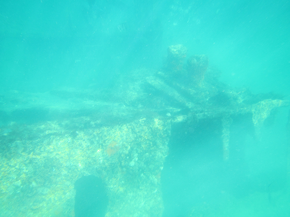
Today, Carl Gerhard rests offshore of Kill Devil Hills, N.C. Known as part of the "Triangle Wrecks," the site consists of the remains of Carl Gerhard and two sections of Kyzikes. These sites are popular with fishermen, snorkelers, as well as divers.
Depending on conditions, visibility can vary from 2-3 feet to about 20 feet or more. The site is best dove at high tide after a period of little wind. On the site, divers will see scattered hull plates, massive boilers, the engine and other wreckage resting approximately at a max depth of 20 feet. The bow of the Carl Gerhard faces towards the beach with substantial hull plating remaining.
Historical Background
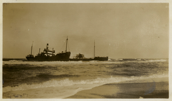
The 244 foot long freighter Carl Gerhard was built in Larvik, Norway in 1923. Owned by a Swedish company, Trelleborg Angfartygs AB, Carl Gerhard was bound for Florida in the fall of 1929 carrying a load of plasterboard. On this voyage from Mabou, Nova Scotia to Tampa, Fl., Carl Gerhard ran into trouble. The vessel stranded in the mud off Mabou soon after sailing and was thought to have sustained little damage and continued to venture south. Within days though, Carl Gerhard became stranded in bad weather.
On September 23, 1929, Carl Gerhard was being battered by stormy winds off the New England coast and began to veer off course. The weather was very overcast during this period, making it much too difficult to even take sights for navigational purposes. According to Captain A. Ohlsson, the ship and crew had been lost for five days, searching in vain for the stars or sun above, or warning beams from lighthouses on shore. Captain Ohlsson thought he was at least 50 miles out at sea until the moment Carl Gerhard came to a sudden stop on the outer bar off Kill Devil Hills, N.C. This was quite a surprise to both the captain and crew. Carl Gerhard crashed through the sand reef and into the sunken hull of Kyzikes, another freighter that wrecked in the same spot just two years prior.
A local spotted the vessel soon after dawn the next day and summoned the four Coast Guard crews under command of Keeper Herman Smith at Bodie Island Station. Unfortuantely, sea conditions proved too rough for boat service, so the "lyle" gun was placed in position. The "lyle" gun was fired from the shore, shooting out a line that could be used to ferry members of the crew from the ship to the shore.
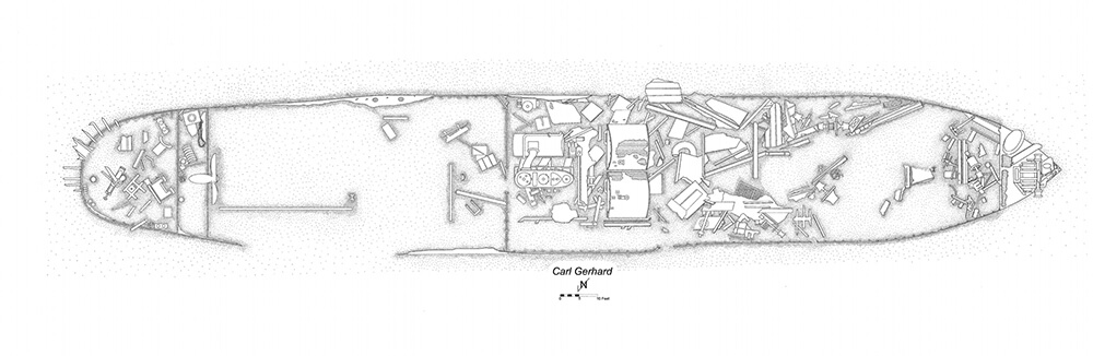
Site Plan
To view additional site plans click here.