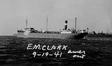
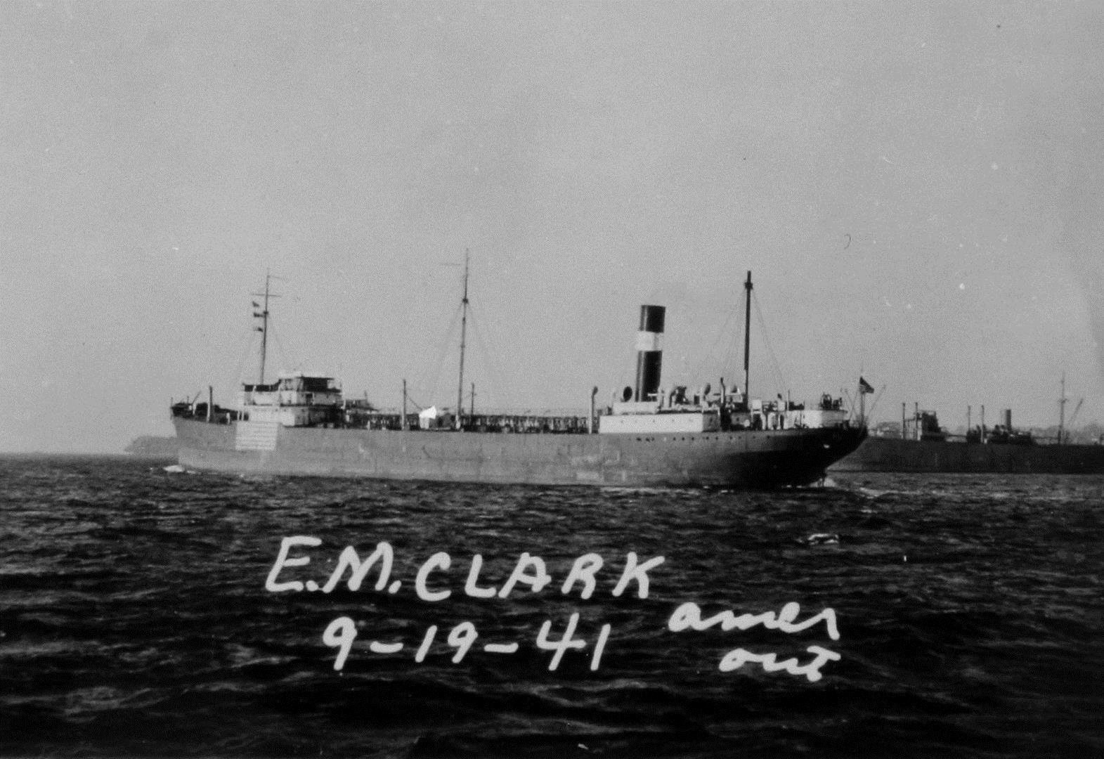
E.M. Clark


Ship Stats
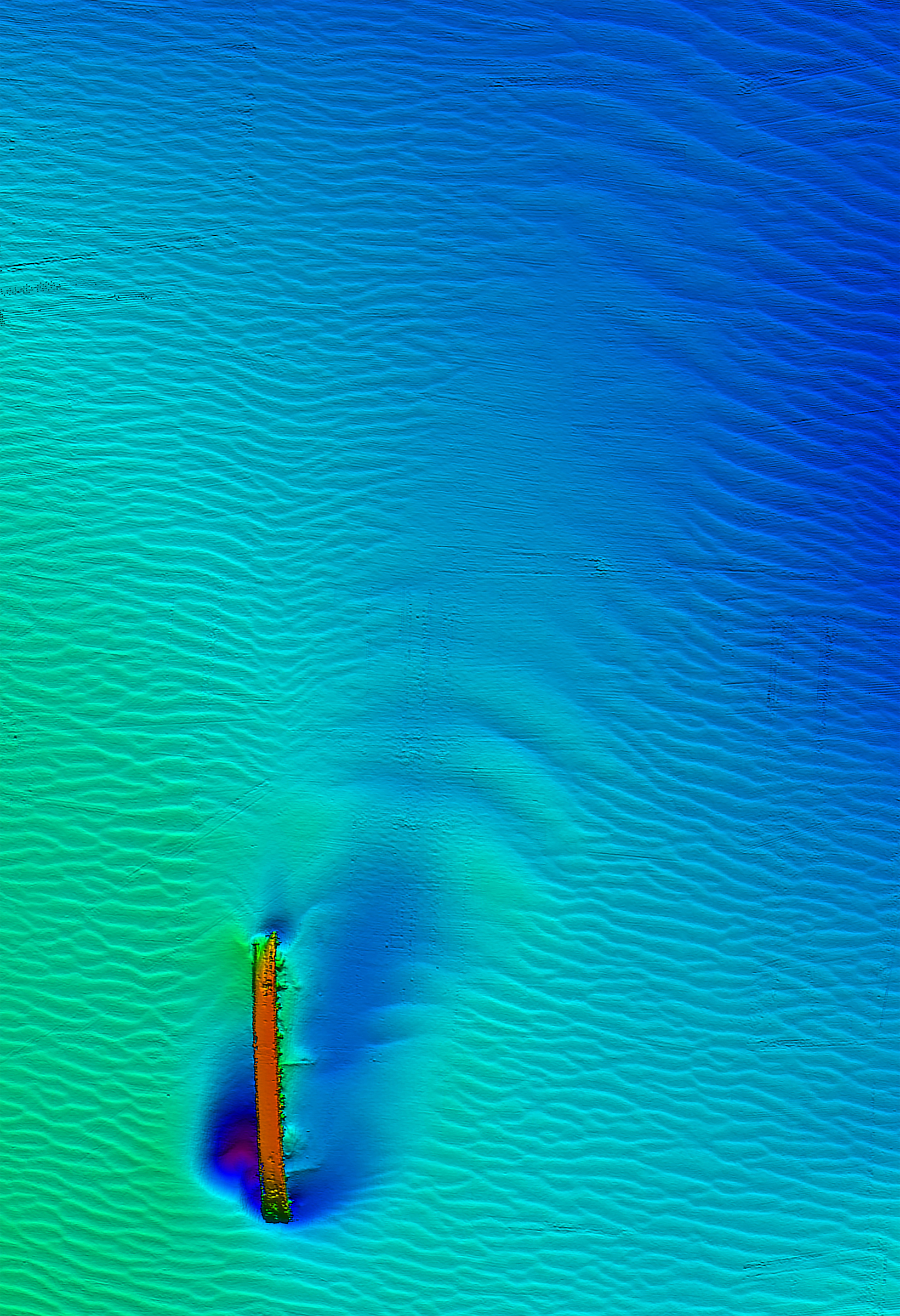
Location: 34°50'34.08"N, 75°32'15.83"W (34.84280, -75.53773)
Depth: 260 feet
Vessel Type: Tanker
Length: 499.2 feet Breadth: 68.1 feet
Gross Tonnage: 9,647 Cargo: 118,725 barrels of heating oil
Built: 1921, Federal Shipbuilding Co., Kearny, New Jersey, USA
Hull Number: 49 Port of Registry: Wilmington, Delaware, USA
Owner: Standard Oil Co., New York, USA
Lloyd's Register Details: Steel hull, twin screw, three decks, aft positioned machinery, triple expansion six-cylinder steam engine, Engine 676 NHP
Former Names: Victolite (Imperial Oil Co., Canada, 1921-1926)
Date Lost: March 18, 1942
Sunk By: U-124 Survivors: 40 of 41 (1 dead)
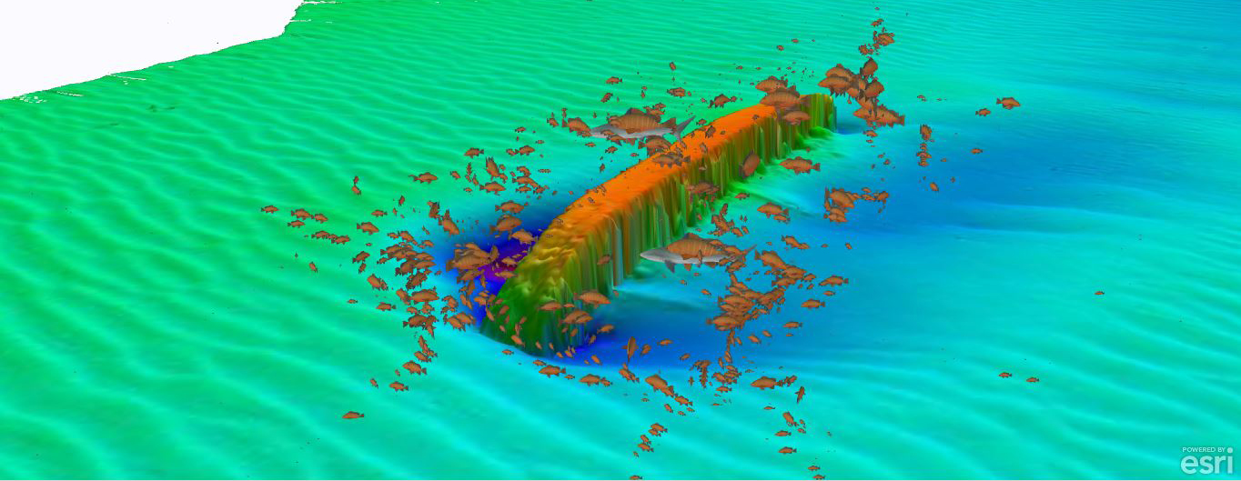
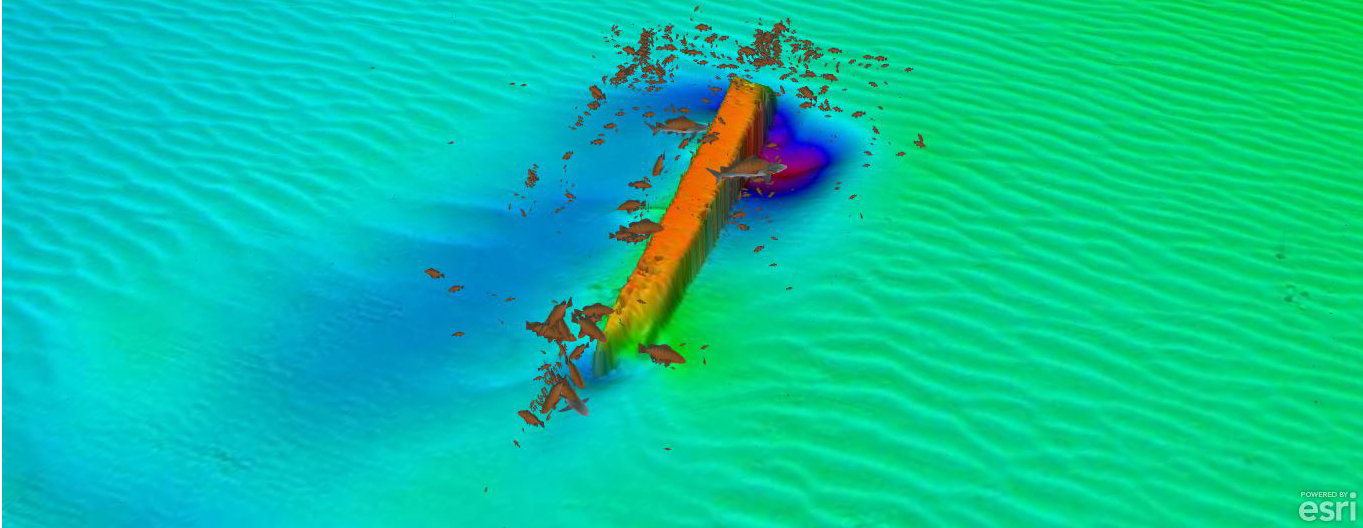
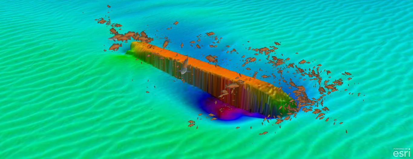
Data Collected on Site: Still and video photography; photomosaic; high resolution multibeam; listed on the National Register of Historic Places
Significance: Casualty of World War II's Battle of the Atlantic; most intact representation of a World War II-era tanker off North Carolina's coast
Wreck Site
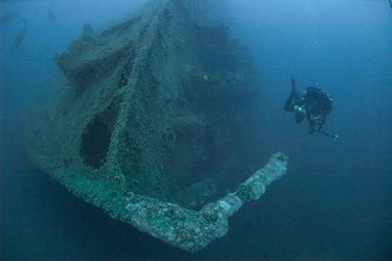
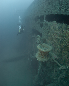
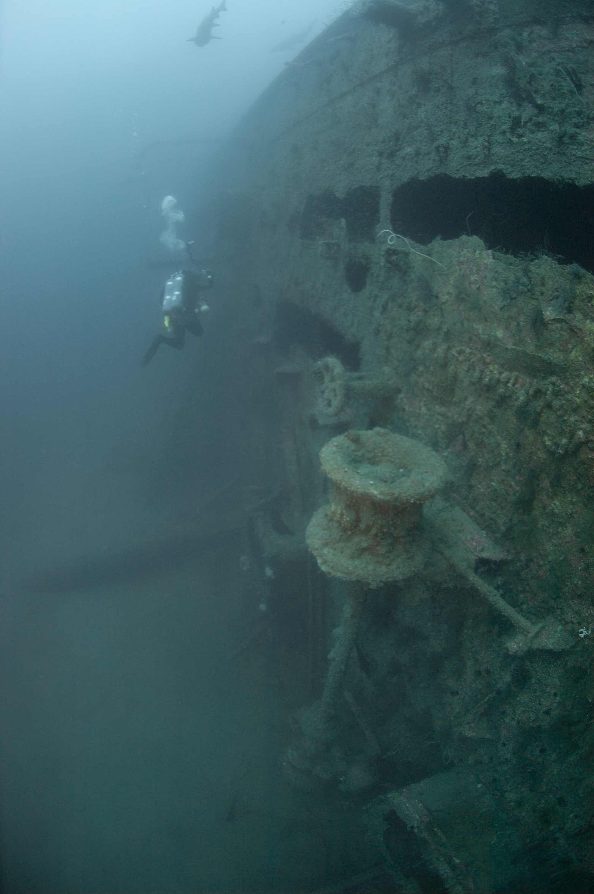
The E.M. Clark is completely intact from stem to stem. The ship sits on its port side at 260 feet. The site's main feature is the steel hull, which lies mostly intact lying on its port side. The hull's exterior steel plates are in excellent condition with small areas of deterioration caused by the strong currents at the site. The wreck's highest point is the starboard side of the main deck edge that sits at least 50 feet off the seafloor. The bow's starboard anchor is in place with the port side anchor buried in the sand under the vessel. The large single rudder and two propellers and shafts are intact with the entire starboard propeller visible, but only half of the port side propeller is protruding from the sand.
Historical Background
During World War II, E.M. Clark was part of a larger transportation network that carried petroleum products to support the Allied war effort both at home and abroad. It made 41 voyages and carried over four million barrels of petroleum products. Destined for New York, E.M. Clark was carrying 118,000 barrels of heating oil, when on March 18, 1942, the crew of U-124 spotted the tanker 22 miles southwest of the Diamond Shoals Light Buoy. The squall-like conditions made it easy for the captain of U-124 to get close to E.M. Clark and fire one torpedo.
The torpedo hit the tanker's port side, and the explosion buckled the tanker's deck. While the crew of E.M. Clark attempted to rig an emergency radio, another torpedo ripped through the vessel sinking it in ten minutes. Although the ship sank quickly, 40 of the 41 crewmembers managed to escape in two lifeboats.
2016 Surveys
Click on the images below for a larger image.
Photomosaic

Site Plan
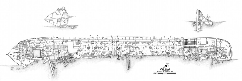
Final archaeological site plan of E.M. Clark. Click here for a larger PDF image. Photo: NOAA
To view additional site plans click here.