F.W. Abrams


Ship Stats
Location: 34°59'24.42"N, 75°48'3.60"W (34.99012, -75.80100)
Depth: 85 feet
Vessel Typle: Tanker
Length: 467.6 feet Breadth: 62.7 feet
Gross Tonnage: 9,310 Cargo: 90,000 barrels of crude oil
Built: 1920, New York Shipbuilding Corporation, Camden, New Jersey, USA
Hull Number: Unknown Port of Registry: Wilmington, Delaware, USA
Owner: Standard Oil Company, New Jersey
Lloyd's Register Details: Steel hull, two decks, one shelter deck, longitudinal framing, fitted for carrying petroleum in bulk, fitted for oil fuel, four cylinder engine
Former Names: Nora (Grace Line Inc., N.Y., 1920-1932)
Date Lost: June 15, 1942
Sunk By: Mine Survivors: 36 of 36 (0 dead)
Data Collected on Site: Side scan sonar; still and video photography; full site plan
Significance: Casualty of World War II's Battle of the Atlantic
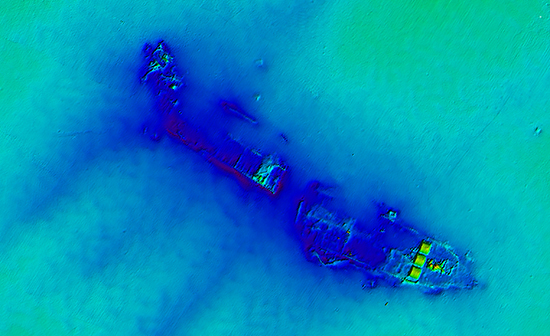
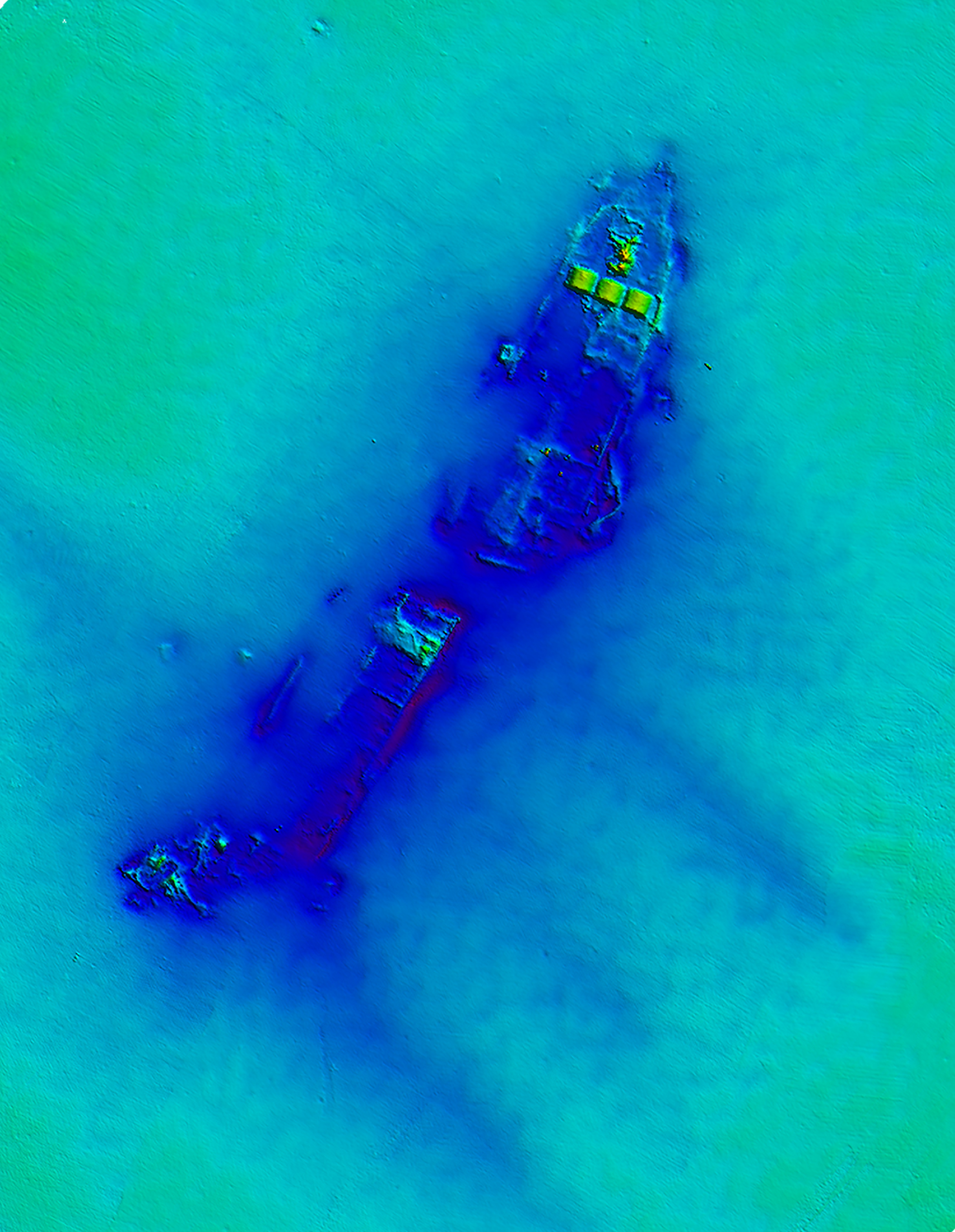
Wreck Site
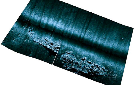
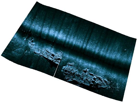
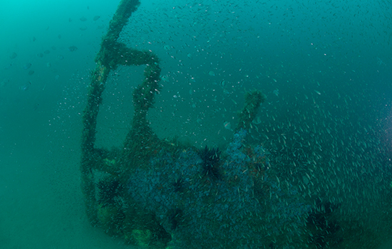
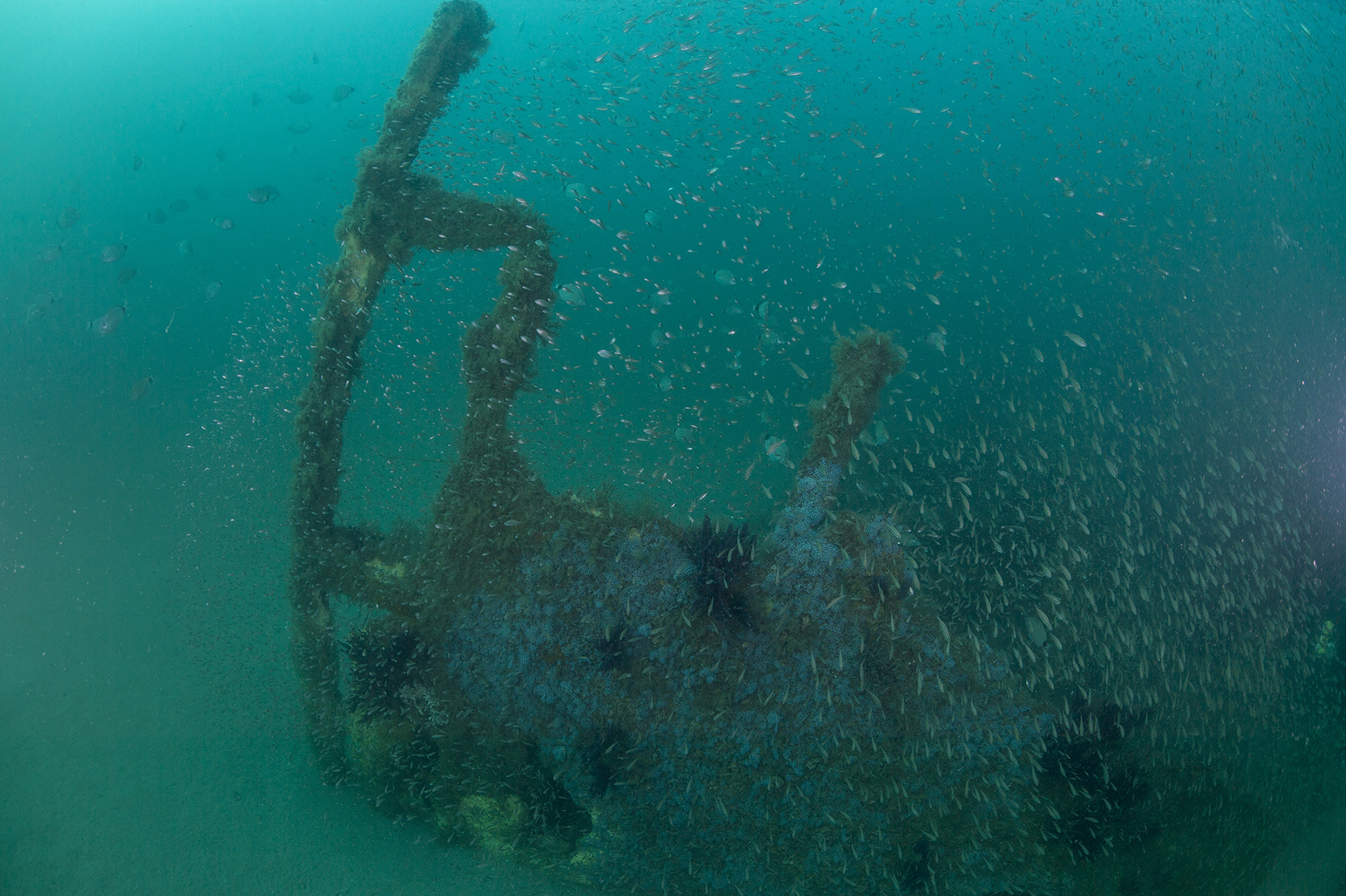
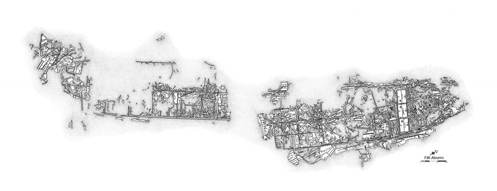
The site rests at approximately 85 feet deep. Presumably, the vessel was sunk after striking a series of mines, which appears to have broken the vessel amidships. There is about a 30 foot gap between the two sections, and they are slightly offset, suggesting that the damage succeeded in actually breaking the keel. Due to the sites location in shallow water, it was a navigational hazard and several destructive techniques were applied to the site. As a result, little relief persists at the site. The boilers and engineering space represent the shallowest points. All three boilers remain in situ; however, much of the engine housing is destroyed revealing the internal pistons. Other prominent features are visible throughout the wreck site, and the bow is still evident. Due to the close proximity to shore, visibility at the site is often unpredictable and can be quite good, or quite poor.
Historical Background
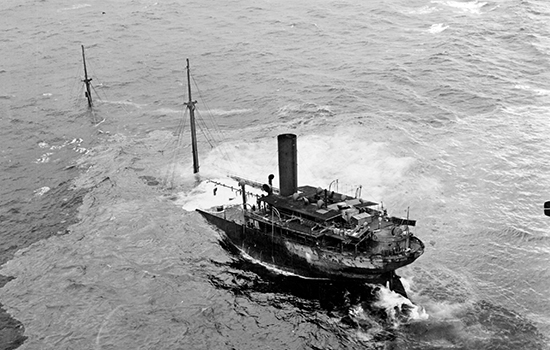
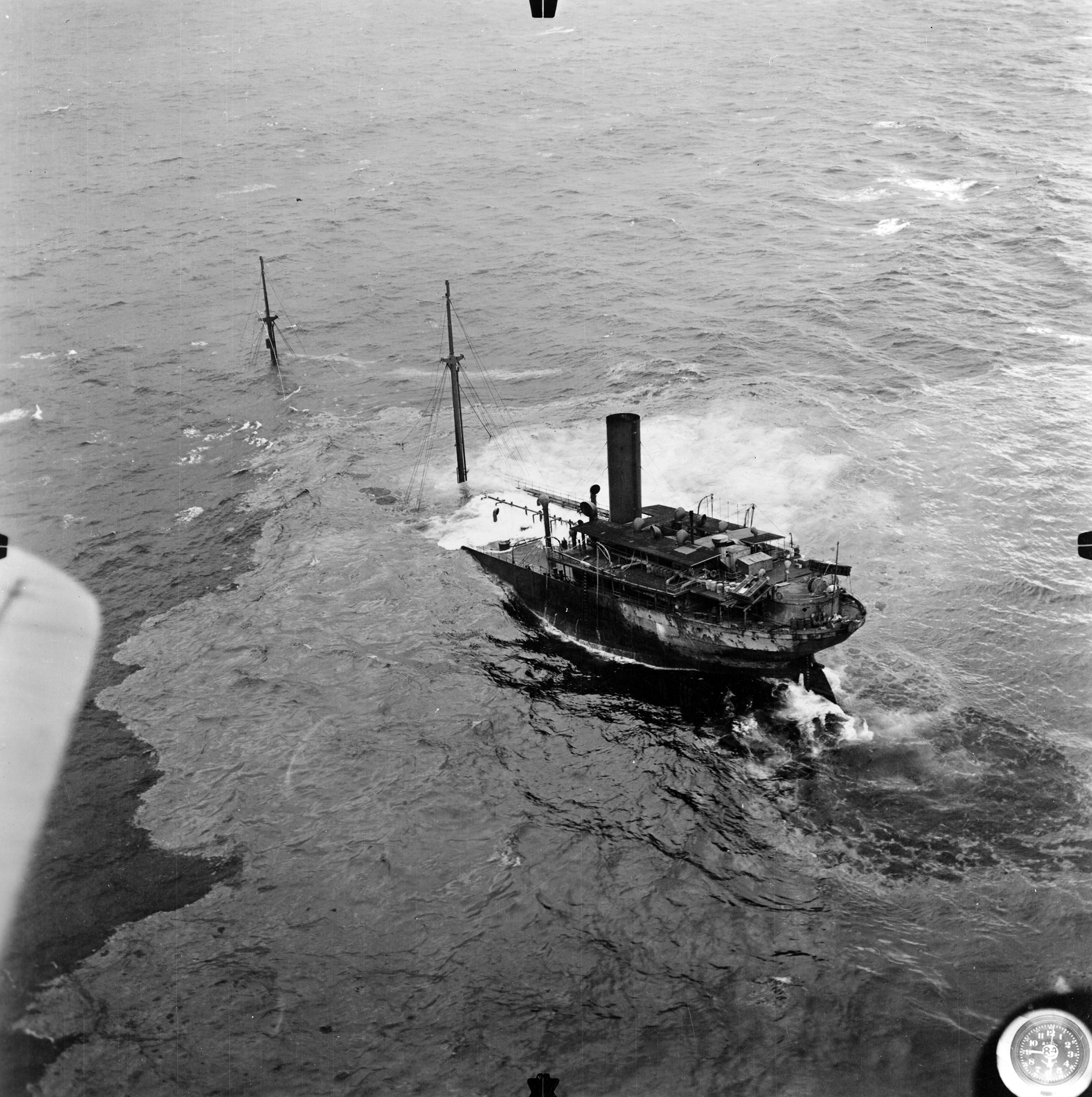
On June 2, 1942, F.W. Abrams left Aruba, traveling unarmed and alone, carrying over 90,000 barrels of crude oil with a destination of New York City. On June 10, 1942, F.W. Abrams sought refuge in the minefield that had been created to offer Allied vessels safety from German U-boats patrolling off Cape Hatteras, North Carolina. F.W. Abrams was escorted into the minefield by Coast Guard patrol craft, CGC-484, and sat at anchor until about 4:00 am the following morning. At that time, the patrol craft returned to secure F.W. Abrams's safe exit from the minefield.
During the transit out of the minefield, F.W. Abrams lost sight of the escort in a heavy rain and made a change of course to head out to sea. After making the change, an explosion rocked the ship from the starboard bow at 6:40 am. Drifting northward, the tanker was hit in the pump room thirty minutes later, as another explosion rocked the bow. The captain and crew believed they were under attack from a submarine. At 7:40 am on June 11, the captain ordered the crew to abandon ship. Of the 36 person crew, all were safely rescued and taken to Ocracoke Island, North Carolina. Only one sailor sustained injuries. The captain remained in Ocracoke for a few days following the incident, hoping the vessel could be salvaged. This proved not to be the case as F.W. Abrams slowly sank beneath the waves, finally submerging on June 15th.
Review of the incident, including the location of the vessel as it strayed from its escort in foul weather, convinced Fifth Naval District officers that F.W. Abrams had, in fact, strayed into the minefield. Contrary to its intended purpose to protect against German U-boats, the minefield claimed a casualty.
Site Plan
To view additional site plans click here.