Merak


Ship Stats
Location: 35°8'12.69"N, 75°17'9.10"W (35.13686, -75.28586)
Depth: 135 feet
Vessel Type: Freighter
Length: 326 feet Breadth: 46.9 feet
Gross Tonnage: 3,024 tons Cargo: Approximately 5,600 tons of coal
Built: 1910
Hull Number: 25 Port of Registry: Wilmington, Del., USA
Owner: United States Shipping Board; Van Nievelt, Goudriaan & Co Stoomvaart Mij. N. V.
Lloyd's Register Details: N/A
Former Names: N/A
Date Lost: August 6, 1918
Sunk By: U-140 Survivors: 43 of 43 (0 dead)
Data Collected on Site: Side scan sonar, still photography, high resolution multi-beam sonar
Significance: Casualty of World War I, sunk by U-140
Wreck Site
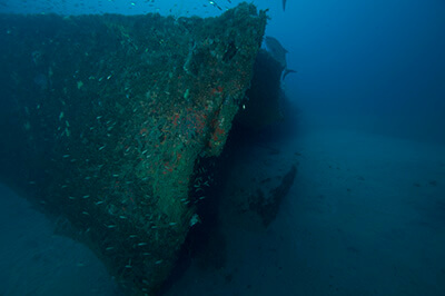
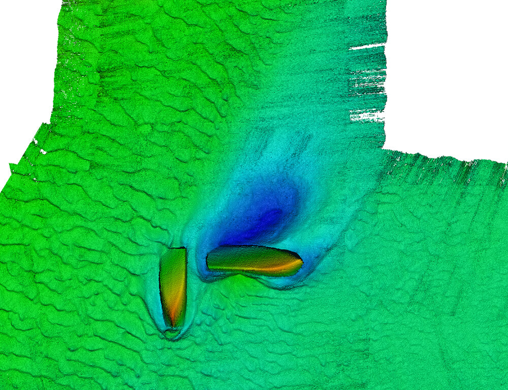
Not far from the Diamond Shoals Light Tower rests a shipwreck believed to be the World War I-era freighter Merak. A definitive identification of the site is difficult because the vessel’s remains are upside down, exposing the hull rather than deck-level features. However, there are several aspects of the shipwreck that make for a compelling argument for the site to be Merak.
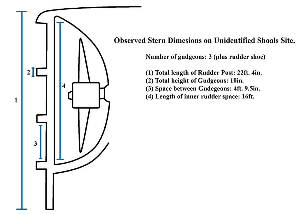
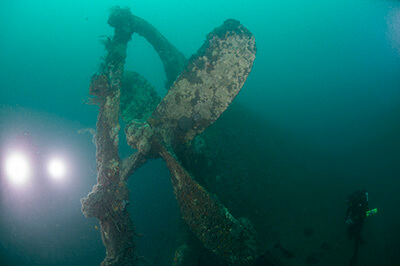
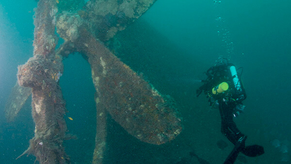
The wreck is located in the same area that Merak was reported lost; it also has similar general dimensions and a single screw propeller. When they examined the site, NOAA archaeologists also noticed a particularly interesting feature. It was the number of gudgeons, which are socket-like, cylindrical fittings used as part of the rudder system. NOAA archaeologists found that there were the same number (three plus the rudder shoe) as indicated on the builder’s plan for Merak. Only one other vessel, Olympic, had been proposed to fit the identity of these ship remains, but that vessel has five gudgeons plus the rudder shoe.
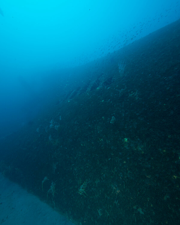
Today, divers will find the shipwreck resting in approximately 135 feet of water about four miles from the wreck of the Diamond Shoals Light Vessel LV-71. The site usually has a strong current and is almost consistently in warm Gulf Stream water. The wreck is broken into two large sections, which are upside down and perpendicular to each other in an L-shape. There is a gap of about 60 feet between the two sections. The stern section is larger, with the single propeller pointing approximately to the east. The bow section lies 90 degrees to stern with two torn-open ends close to each other, and as you go down the prevailing current, you will find the end of the bow.
Historical Background
The freighter Merak was built in 1910 at the Rotterdam Droogdok Mij. dockyards in the Netherlands. Originally owned by a Dutch company, the freighter ran general cargo from its launch until early 1918. On March 21, 1918, the ship was seized by the U.S. Shipping Board, and pressed into merchant service for the United States war effort. During that time, it continued to sail under the name Merak.
On August 6, 1918, Merak was laden with 5,600 tons of coal heading from Newport News, Virginia, to Chile. As it neared Diamond Shoals off North Carolina, German U-boat U-140, also operating in the area, spotted the freighter. U-140 surfaced, and the crew quickly manned the deck guns for an attack on Merak. The freighter responded by going to full speed and zig-zagging in an attempt to evade the U-boat. The radical course maneuvers bought the ship some time. Although almost 30 shells were fired by U-140, none were reported to have struck Merak.
Unfortunately, during the escape Merak reportedly ran aground on the ever shifting sands of Diamond Shoals. The crew immediately took to the two lifeboats, and the entire 43-member crew escaped. During this time, U-140 turned its attention to the Diamond Shoals Light Vessel LV-71. The light vessel had begun to transmit radio messages warning other ships in the area of the U-boat’s presence, and U-140 was determined to stop the transmissions.
With Merak aground and the crew fleeing the ship, U-140 took its time with LV-71. One round took out the wireless antenna and another landed right next to the ship. The mate in charge ordered an evacuation as there was no way for LV-71 to fight against U-140. The light vessel was at anchor on station, and it would take over five hours to weigh anchor and get underway. The light vessel crew fled in their yawl boat rowing for shore as fast as they could while watching the U-boat shell the light vessel until it went down.
With LV-71 sinking, U-140 pulled up to Merak, and a crew from the submarine boarded the ship. The Germans placed explosives in the bilge of the engine room. U-140 then approached the lifeboats and interviewed the Merak survivors, asking the identity of the ship, its cargo, and other information. Before departing, the U-boat crew asked if the Merak sailors had a sail and gave them their distance from the beach, saying that they should not have any trouble reaching shore. U-140 detonated the explosive charges, and Merak sank quickly with its confirmed location lost to history.