Tamaulipas


Ship Stats
Location: Bow Section 34°32'19.68"N, 76°0'56.12"W (34.53880, -76.01559)
Stern Section 34°32'48.19"N, 76°0'50.11"W (34.54672, -76.01392)
Depth: 155 feet
Vessel Type: Tanker
Length: 434.8 feet Breadth: 56.2 feet
Gross Tonnage: 6,943 Cargo: 70,000 barrels gas oil
Built: 1919, Bethlehem Fairfield Ship Building Corp., Sparrow's Point, Maryland, USA
Hull Number: 4185 Port of Registry: Wilmington, Delaware, USA
Owner: Mexican Trading and Shipping Co., New York, New York, USA
Lloyd's Register Details: Steel hull, two decks, fitted for oil fuel, longitudinal framing, triple expansion three cylinder engine
Former Names: Hugoton (Mallory and Co., 1919-1941)
Date Lost: April 10, 1942
Sunk By: U-552 Survivors: 35 of 37 (2 dead)
Data Collected on Site: Side scan sonar survey; still and video photography
Significance: Casualty of World War II's Battle of the Atlantic
Wreck Site
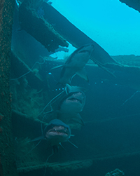
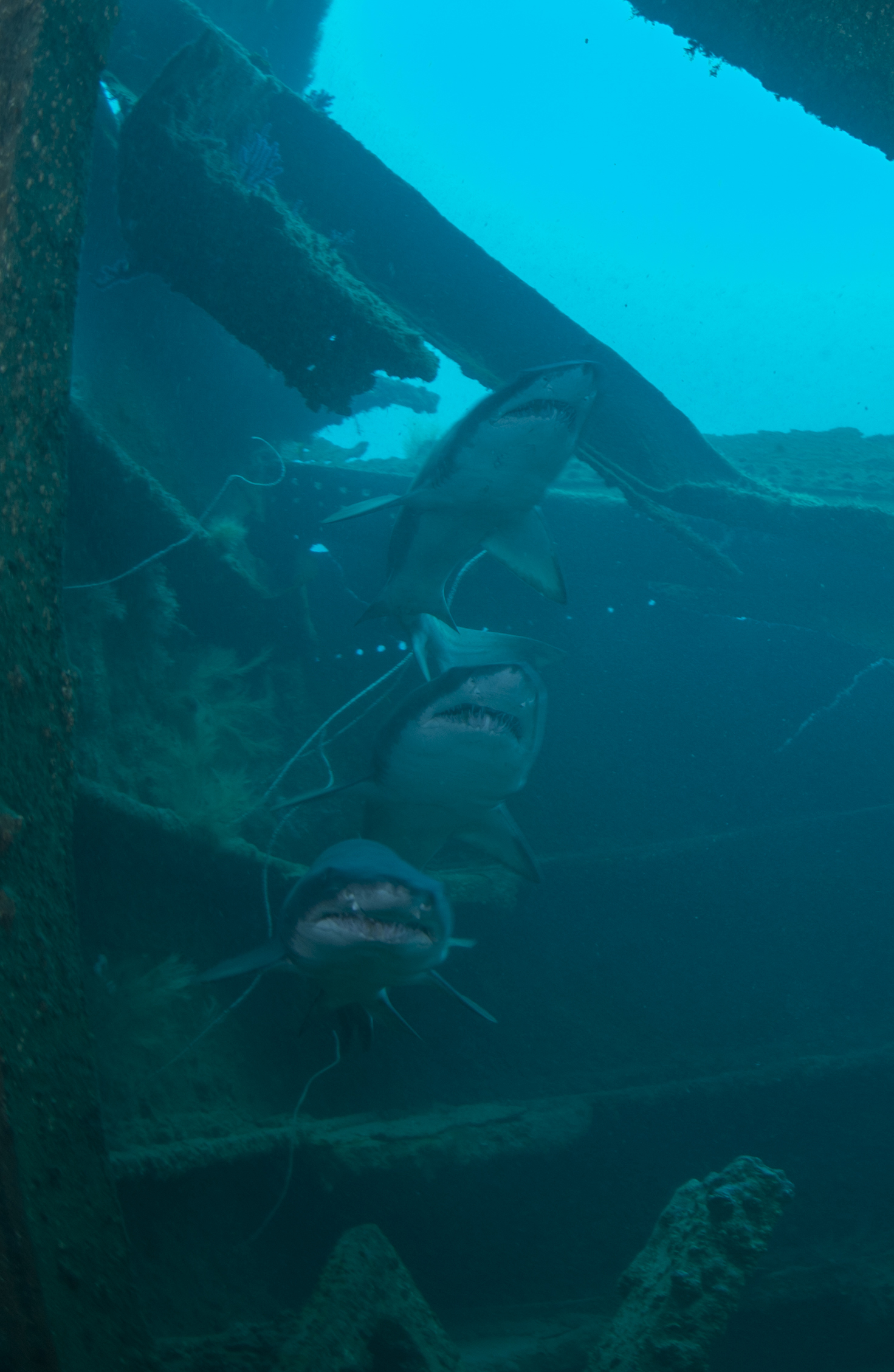
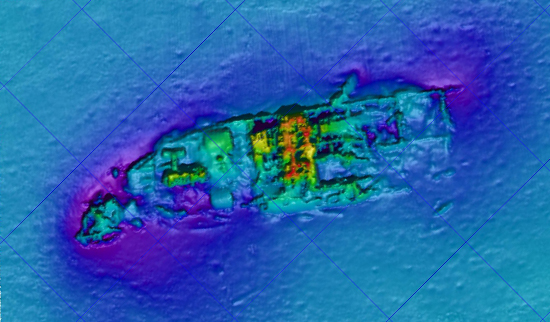
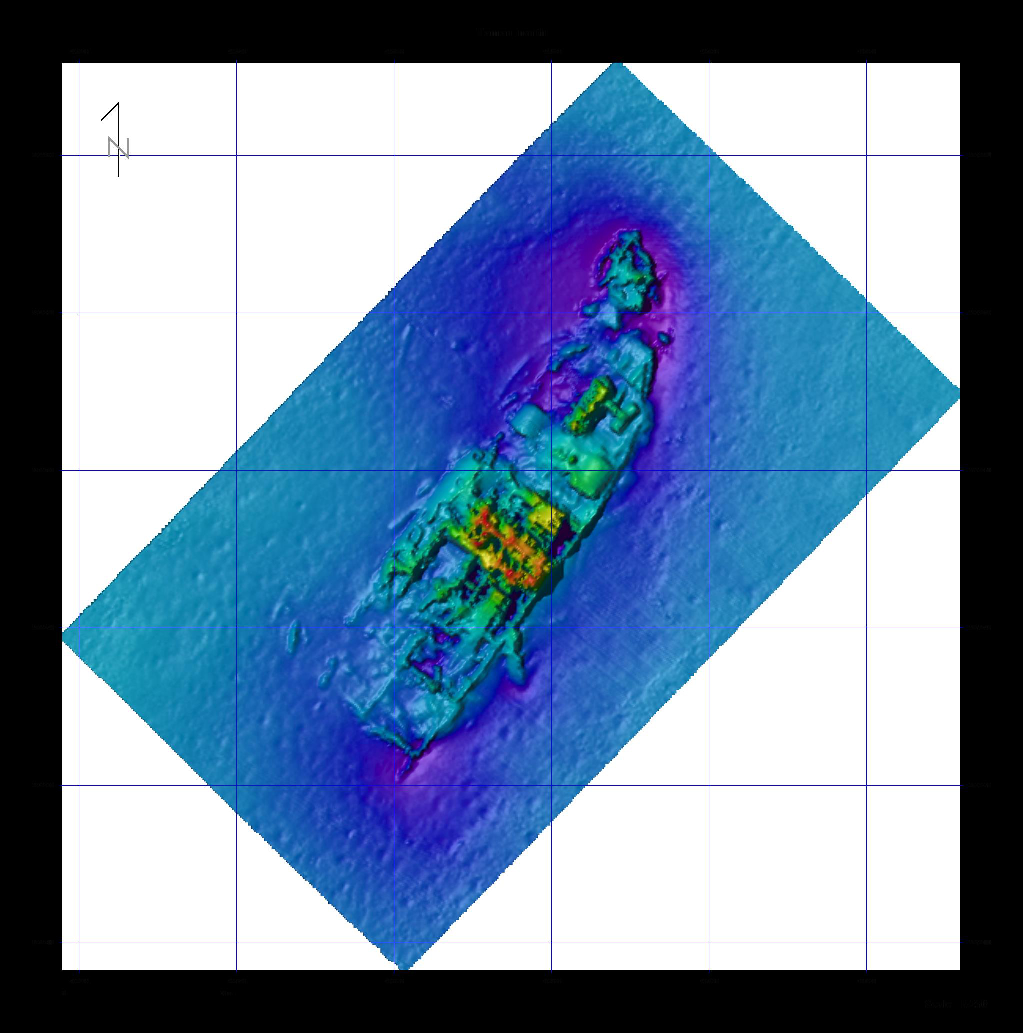
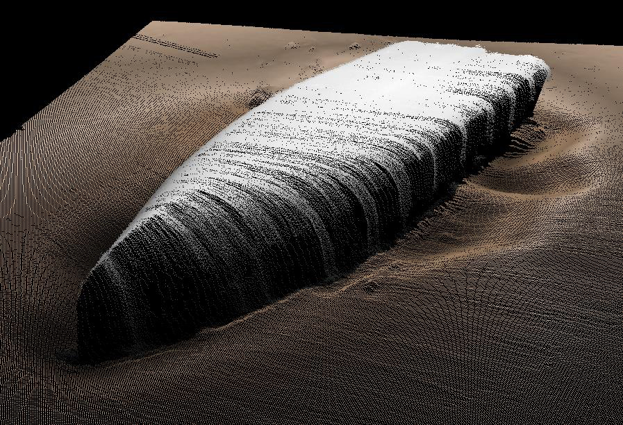
The wreck of Tamaulipas is broken into two sections, resting in about 155 feet of water off Cape Lookout, North Carolina. The vessel broke in two, but only after floating for some time in the current. Therefore, the ship's forward section is located further south than the aft section, and it is turtled and the outer hull is pointing toward the surface.
Located approximately a half mile further north, the aft section of Tamaulipas is sitting upright on the sea bed, with numerous features able to be identified. Large amounts of disarticulated hull and deck structure surround the engine and two boilers. The propeller and rudder are also visible. The distinct fan tail stern is laying to its starboard side, with part of the steering quadrant located adjacent to this structure. This section is contiguous and easily navigable.
Historical Background
Tamaulipas operated on a route from Tampico, Mexico to the United States, carrying petroleum products to refineries on the East Coast. On April 9, 1942, Tamaulipas was traveling alone and unarmed on its way to New York, New York, carrying a full cargo of 70,000 barrels of oil. Early that morning as the ship passed Cape Lookout, North Carolina, a lookout spotted the wake of a torpedo as it crossed the tanker's wake. The captain quickly made an adjustment to travel in a zig-zag course in an attempt to avoid a torpedo striking the ship, but it was for naught. A second torpedo, fired by U-552, crashed and exploded into the starboard side, aft the midship house, near the number five tank. Earlier that morning, U-552 had also attacked and sank another tanker, Atlas.
The explosion and resulting eruption of the flammable cargo broke Tamaulipas in half. Within five minutes of the attack, the captain realized the ship was lost and ordered the crew to abandon ship. The surviving crew made it into the number one and number three lifeboats and escaped from the tanker and burning oil quickly surrounding them. A few hours after the attack, 35 surviving crew members were picked up by HMS Norwich City, where they joined the surviving crew from Atlas. The survivors were all taken to Morehead City, North Carolina.